The Big Dipper over Dorgan House
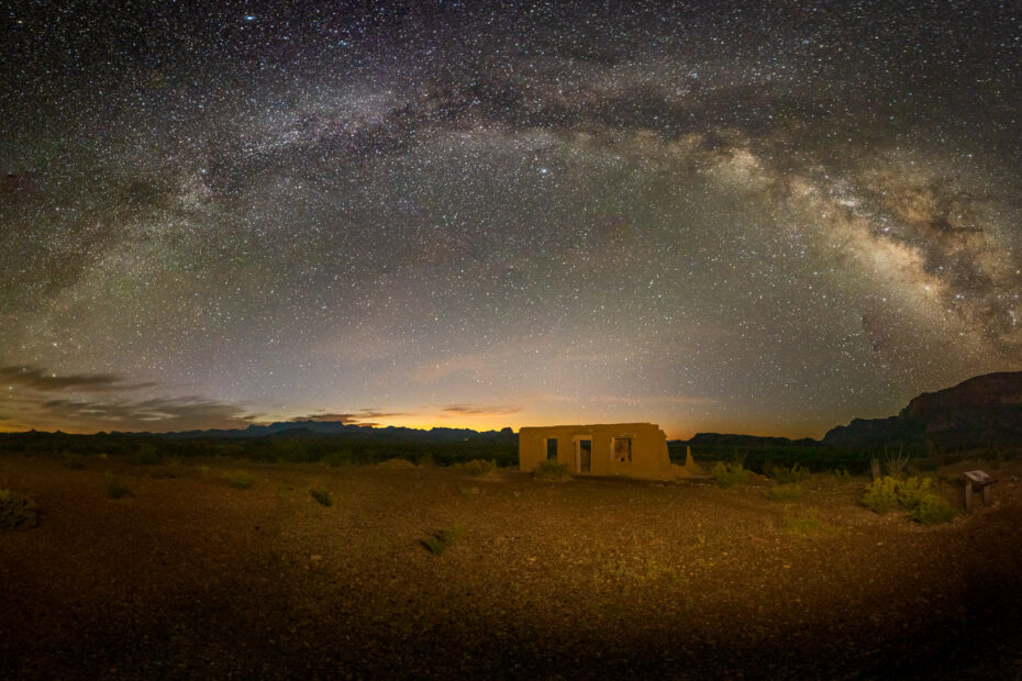
The Big Dipper (Ursa Major) above Dorgan House was photographed in Big Bend National park during the spring of 2023.
Nature and landscapes.
The Big Dipper (Ursa Major) above Dorgan House was photographed in Big Bend National park during the spring of 2023.
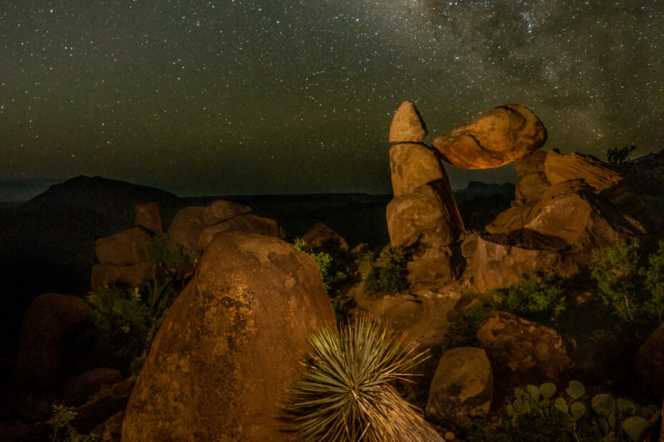
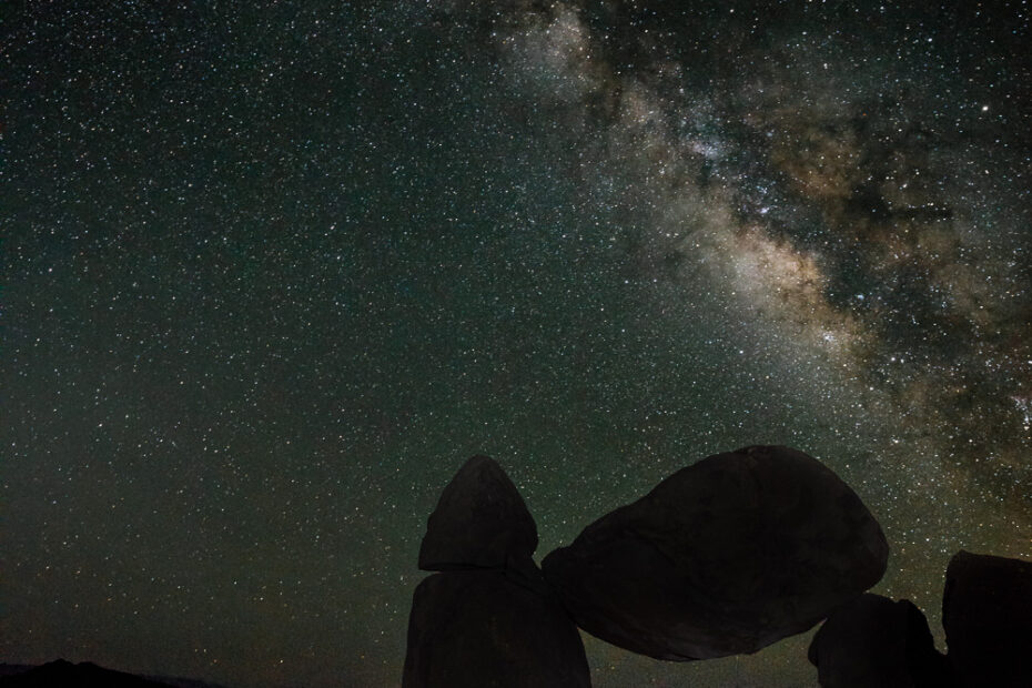
The Milky Way over Balanced Rock along the Grapevine Hills Trail in Big Bend National Park, photographed in the spring of 2023.
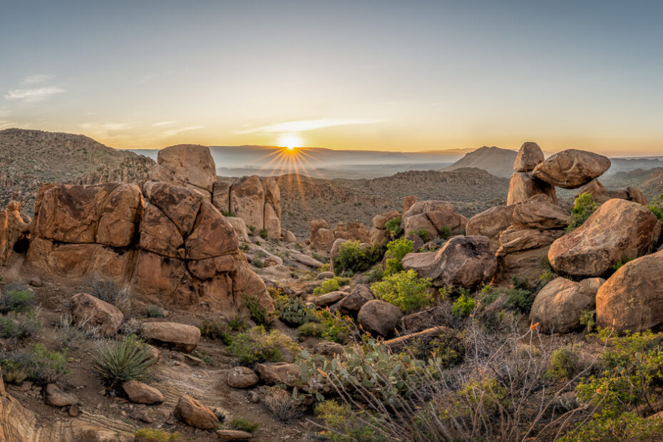
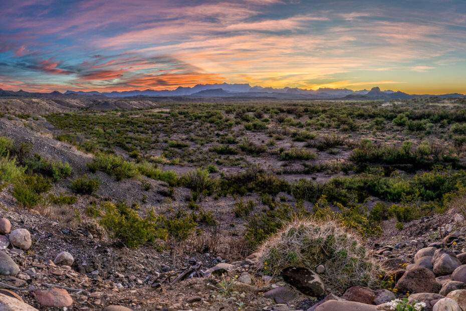
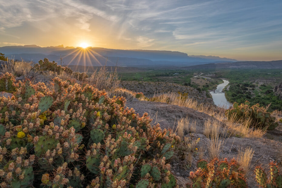
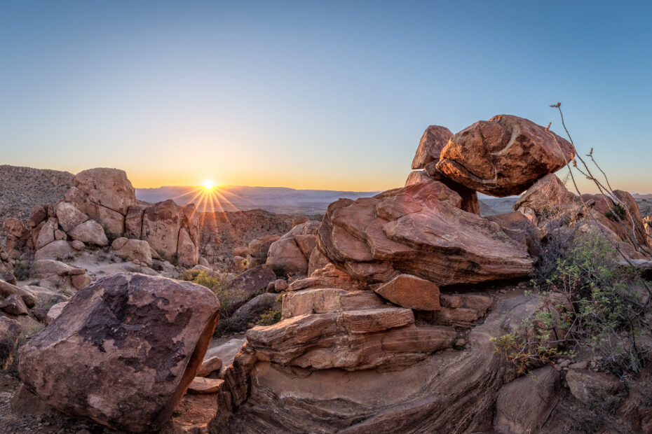
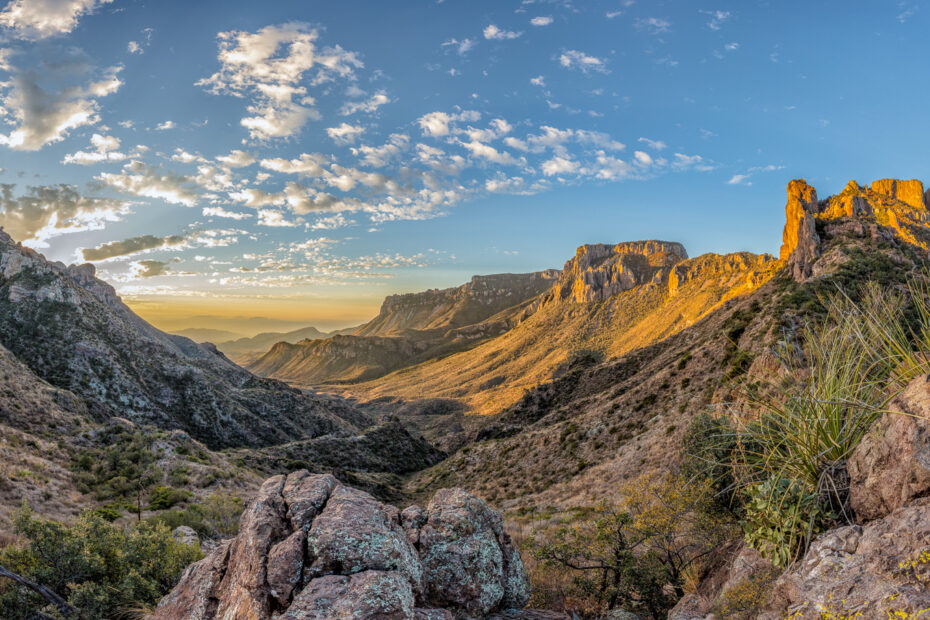
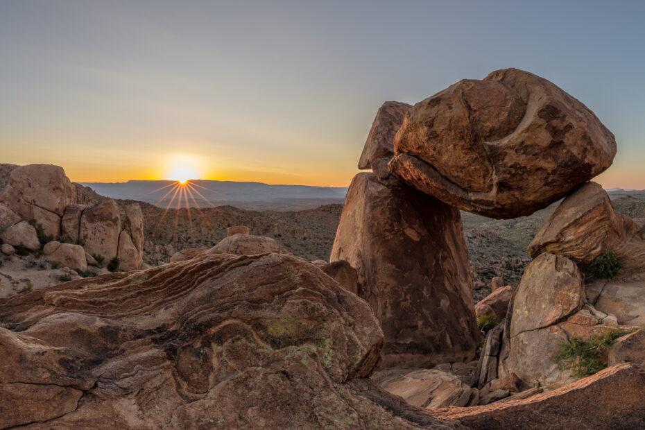
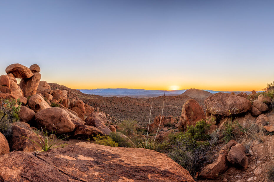
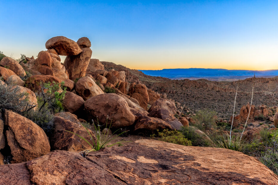
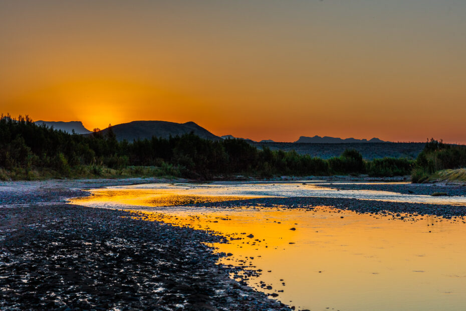
This Balanced rock Sunrise Panorama was taken in Big Bend National Park during a recent visit to the area.
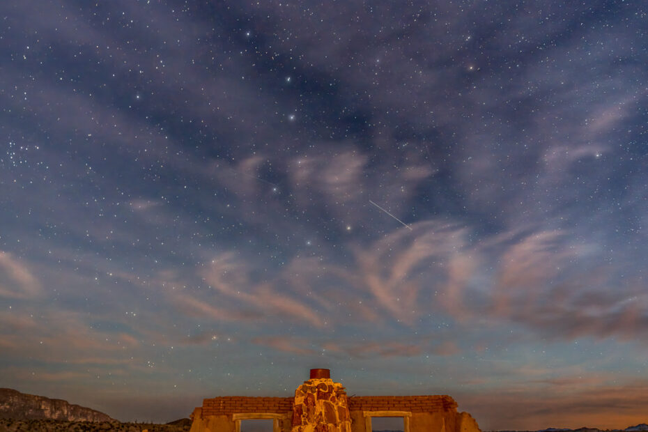
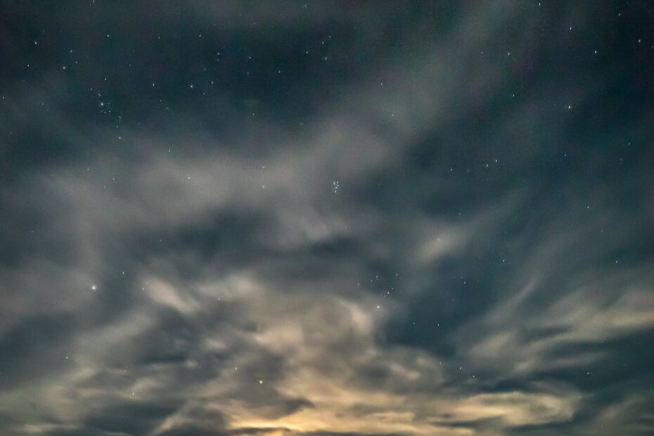
I photographed the Milky Way Over Dorgan House during my visit to Big Bend National Park in the spring of 2023.
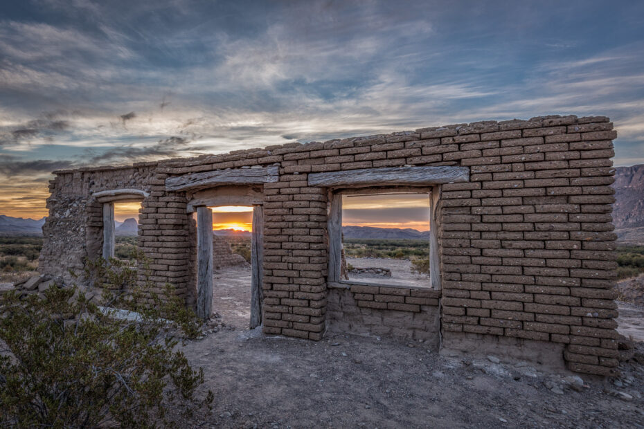
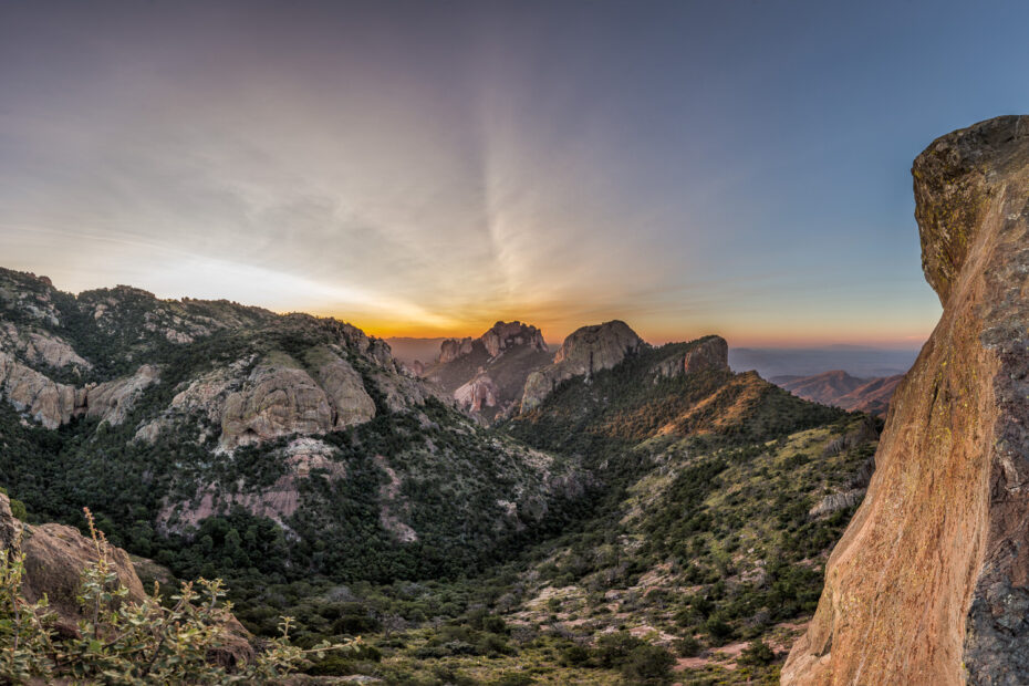
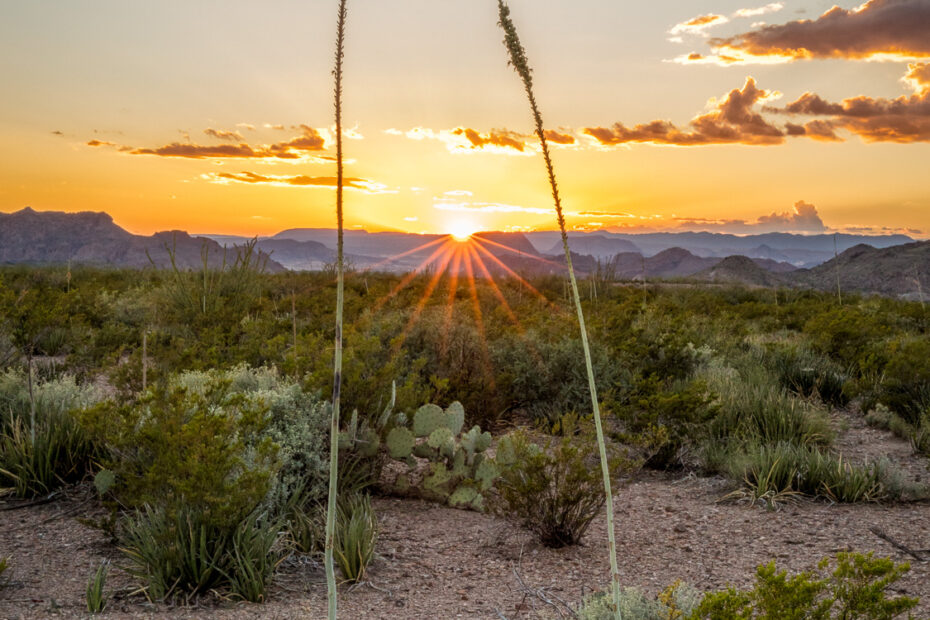
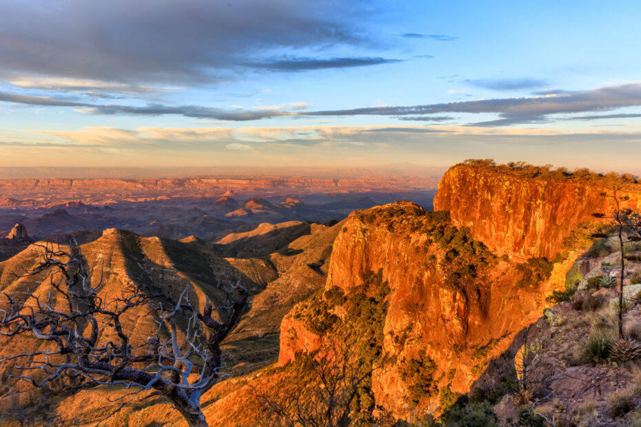
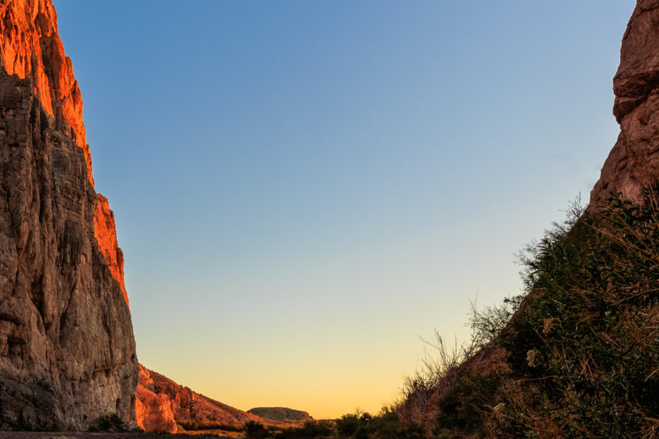
A Chihuahuan Desert Sunrise as seen from the Dorgan House in Big Bend National Park during the Spring of 2023.
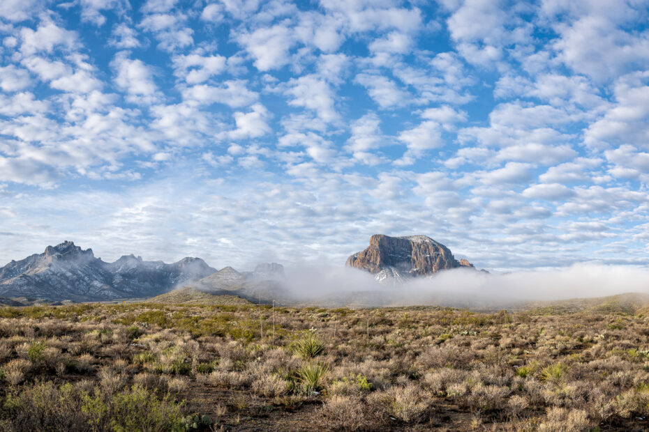
I photographed this foggy Chisos mountains during my first morning in Big Bend National Park during the spring of 2023.
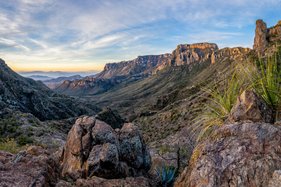
A panorama of The Saddle at Lost Mine Trail in Big Bend National Park, photographed in the Spring of 2023.
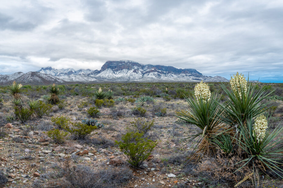
I captured this panorama of the Snowy Chisos Mountains upon arrival in Big Bend National Park in the spring of 2023.
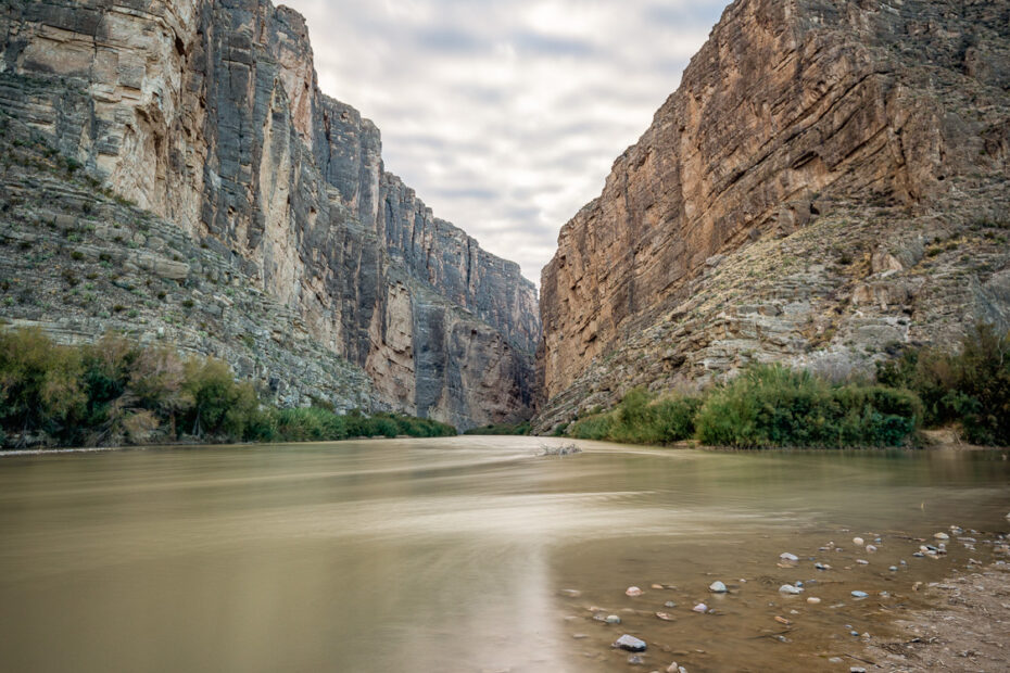
Santa Elena Canyon is one of my favorite locations within the Big Bend National Park. The Canyon is one of BBNP’s geological marvels.
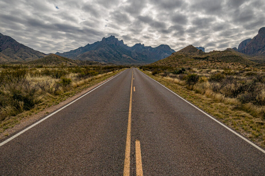
The Road to the Chisos Basin is one of the most scenic roads in the Big Bend National Park. Changes in elevation are accompanied by changes in vegetation.
The Hot Springs Trail Overlook is located near the Rio Grande Village in Big Bend National Park. A great hike with awesome vistas.
A Chihuahuan Desert Sunset taken along the main road on the western end of Big Bend National Park during my recent trip to the area.
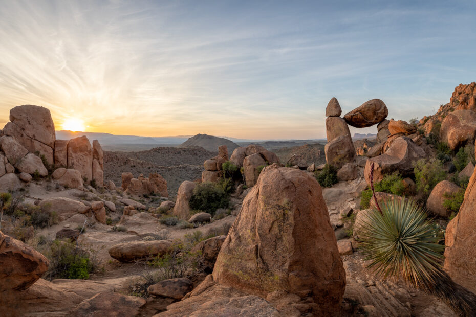
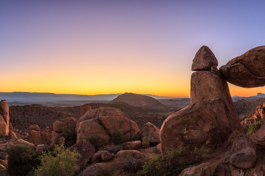
A panorama of Balanced Rock along the Grapevine Hills Trail in Big Bend National Park. Photographed in the spring of 2019.
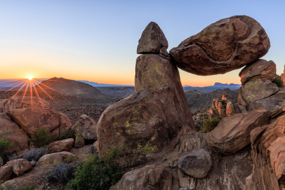
A sunrise on Balanced Rock in Big Bend NP. The sunrise during that moring was great and the light illuminating the rocks was awesome!
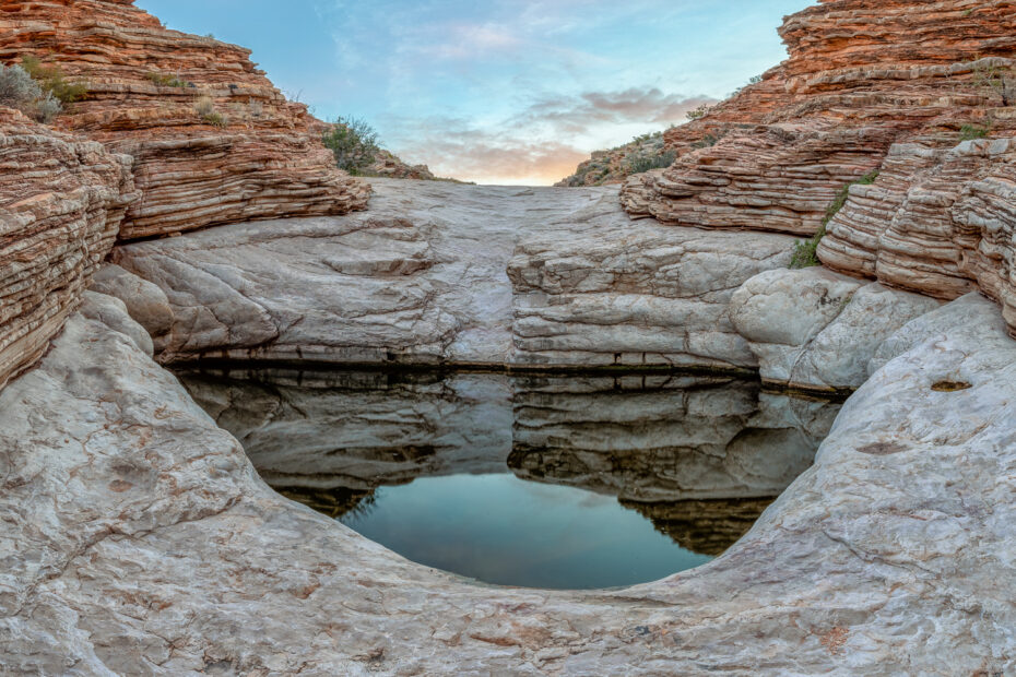
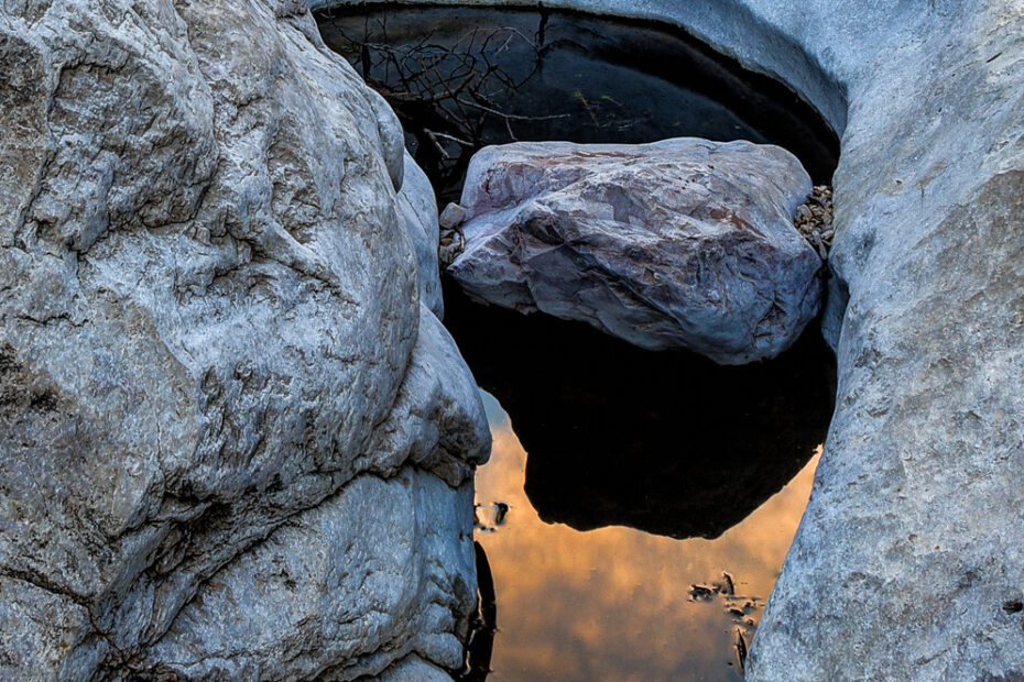
I really enjoy the trip up Old Ore Road, leading to Ernst Tinaja in Big Bend National Park. The road is rough but the hike to the Tinaja is easy.
Balanced Rock is located at the end of the Grapevine Hills Trail in Big Bend National Park. I captured this photo during a cloudy fall day.
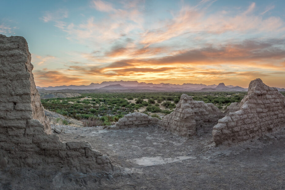
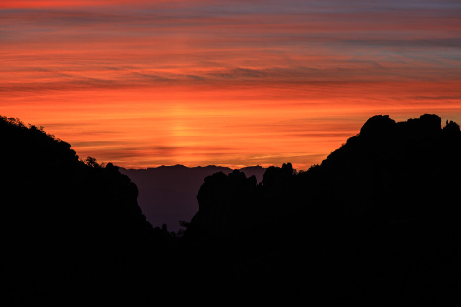
Sunrise at Dorgan House was very special during my recent trip to Big Bend National Park. The colors provided by the sun and the clouds were spectacular. One of the best I have seen in this area.
It is time for my spring trip to Big Bend National Park in west Texas. One of the first events was the hike up Grapevine Hills Trail to photograph a Balanced Rock Panorama.
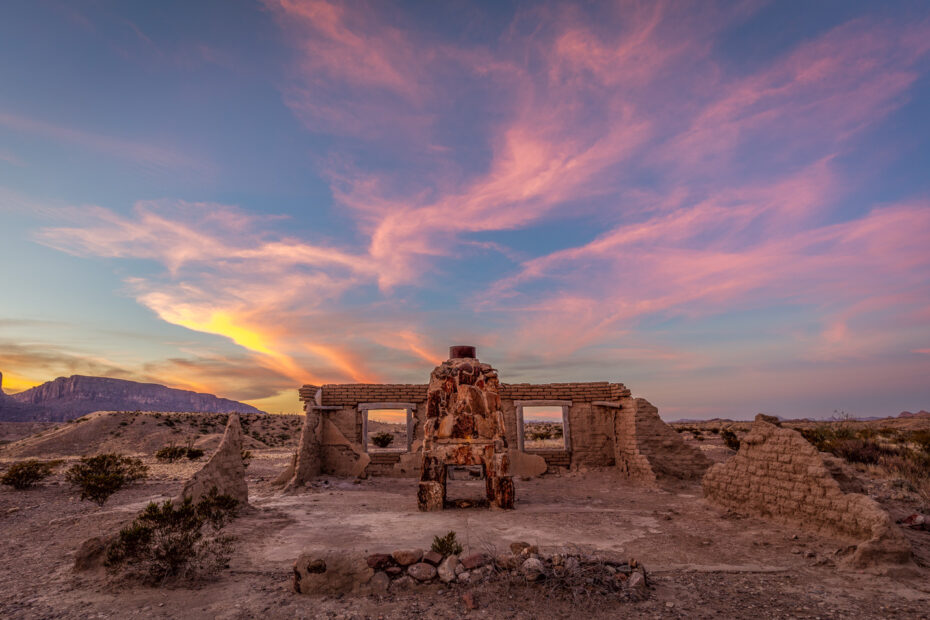
Another Dorgan House Sunset photo from my trip to Big Bend National Park last December. I can only imagine what the Dorgan family’s day was like, especially with their 360-degree views of the wonderful area.
I photographed this view of Castellon Mountain at sunset from the Dorgan house which is located at the end of the Dorgan-Sublett Trail in Big Bend National Park.
Another Juniper Canyon Sunrise. The location can be found about 0.8 miles up the Lost Mine Trail in Big Bend National Park.
This Moon over Chisos photograph is one of my favorite photographs from my fall trip to the Big Bend National Park area.
The Dorgan House along the Dorgan-Sublett Trail in Big Bend National Park taken at sunrise. I posted a few photos of the Dorgan house at sunset but the Dorgan House at Sunrise is special.
A sunset view of Santa Elena Canyon from the Dorgan house along the Dorgan-Sublett Trail in Big Bend National Park.
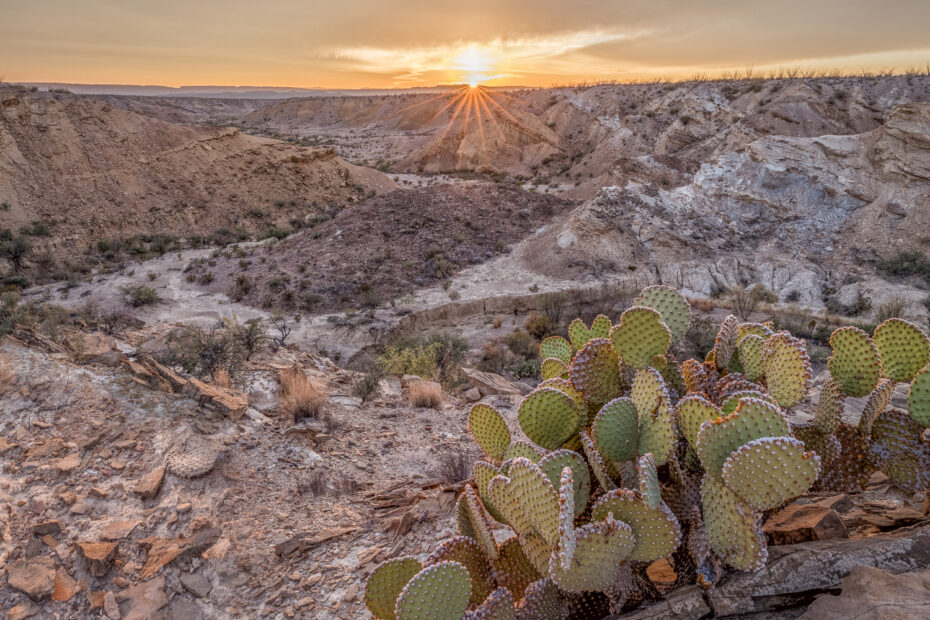
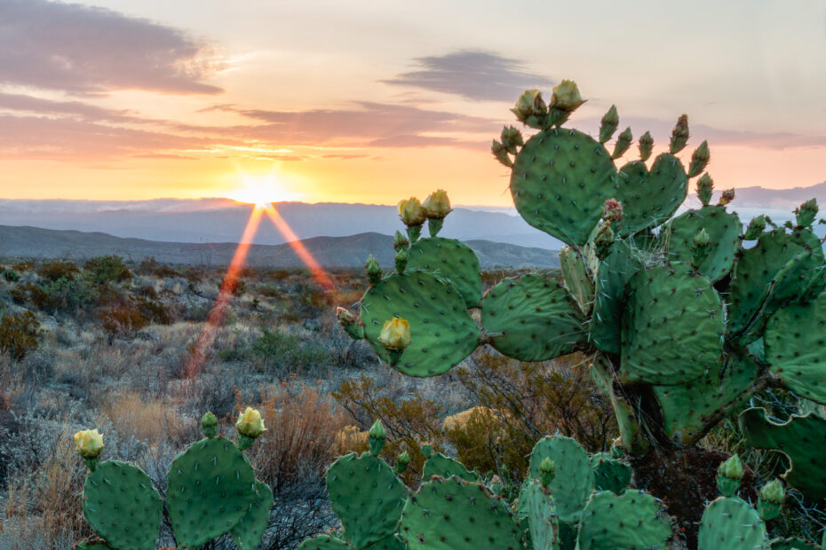
A prickly pear sunrise during my trip to Big Bend NP in the fall of 2017. The skies were filled with clouds which made for a great sunset.
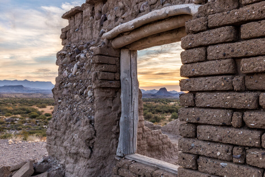
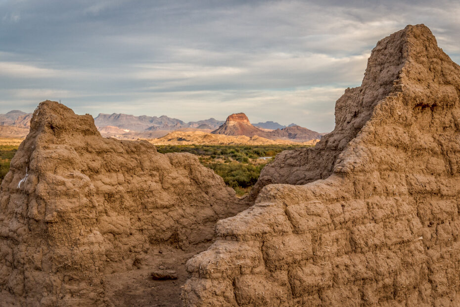
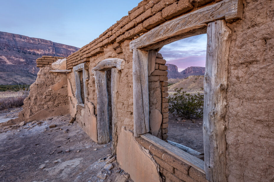
A window to Castellon Mountain as seen from the Dorgan House property in the Dorgan-Sublett in Big Bend National Park.
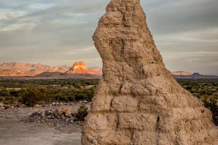
This view of Castellon Mountain is from the Dorgan house in Big Bend National Park. This vantage point is a great place to see the park.
Another great sunset sky in Big Bend NP. Photographing into the sun is very tricky and one must find a balance to capture the image details.
The Big Bend NP desert floor in the spring of 2015 was one of the most colorful desert floors I have ever seen. I hope to see it once again.
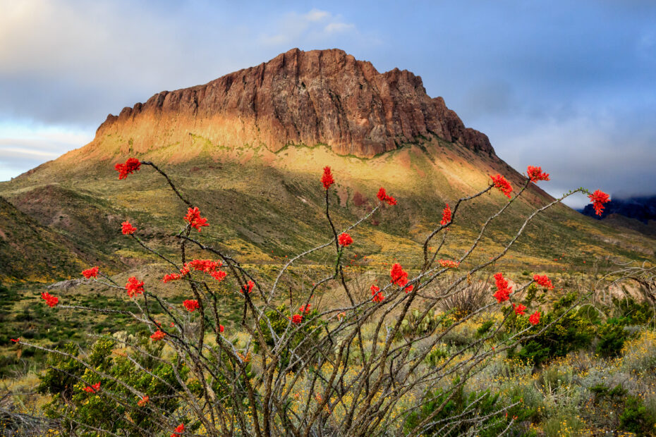
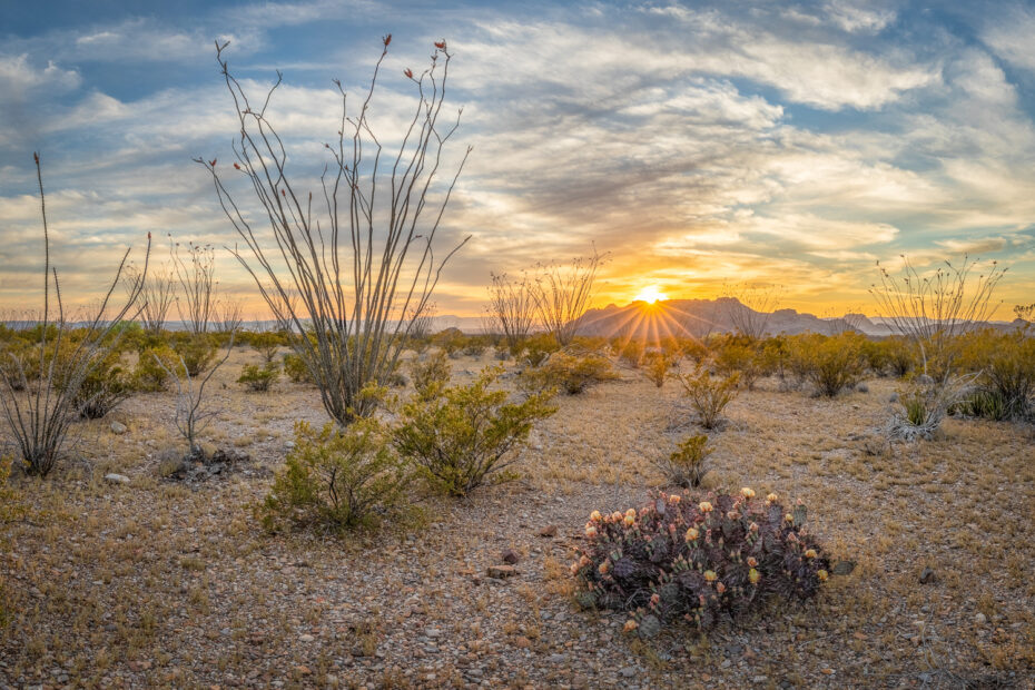
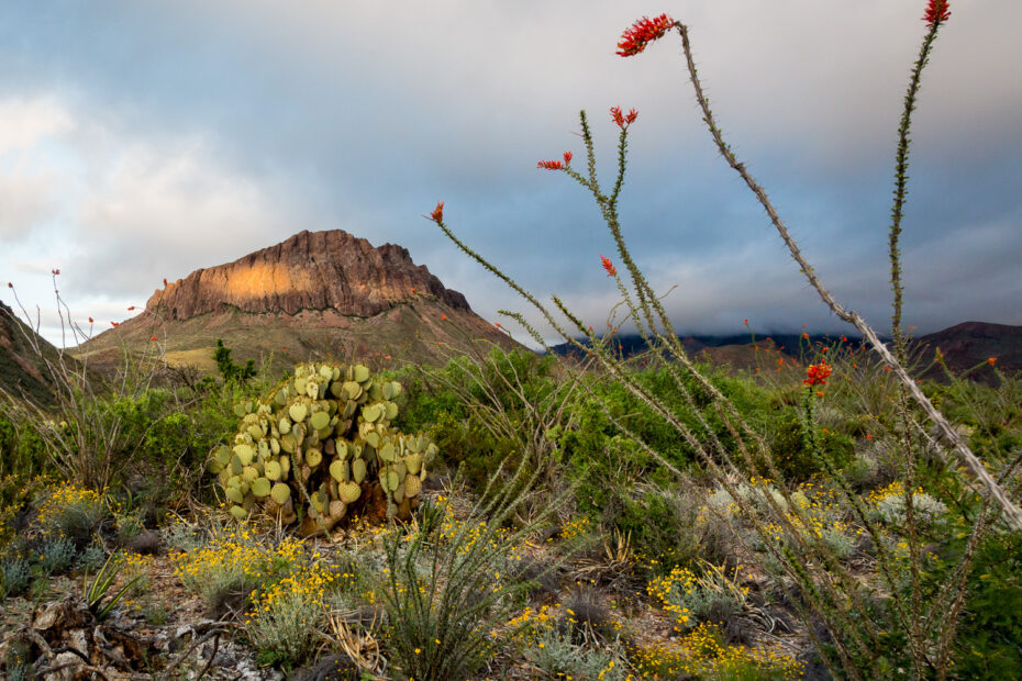
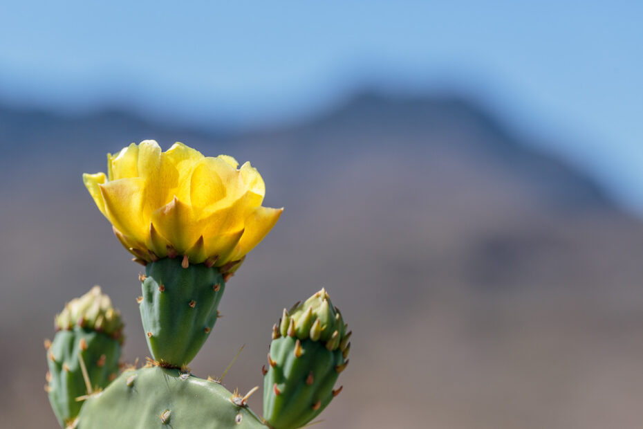
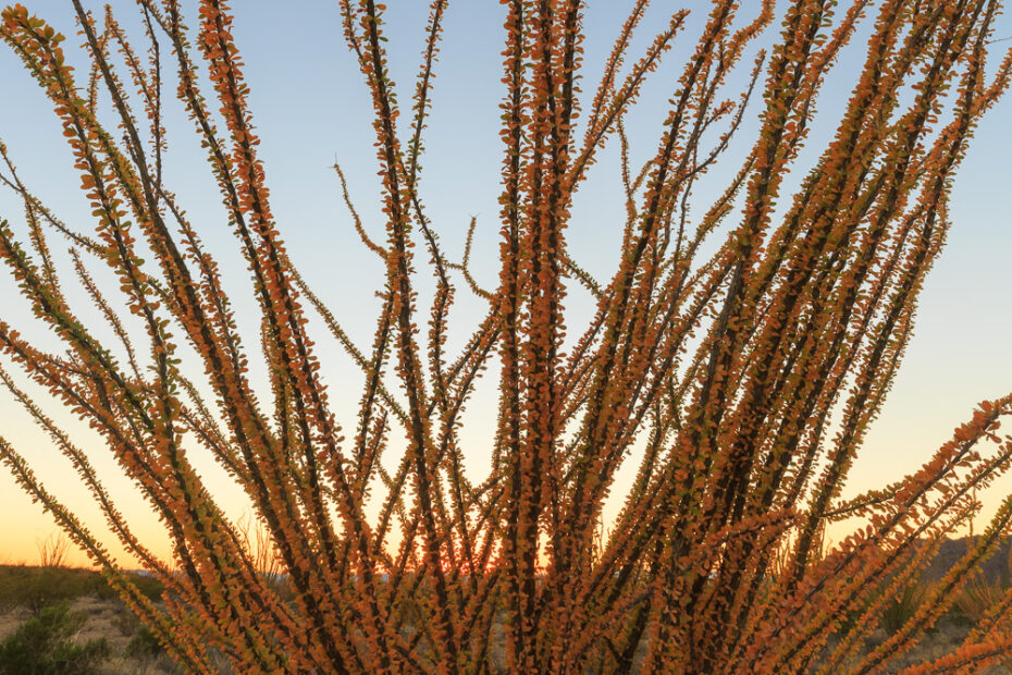
The flowering Ocotillo is one of the brightest flowers on the desert floor. I enjoy photographing them, however, you need calm winds.
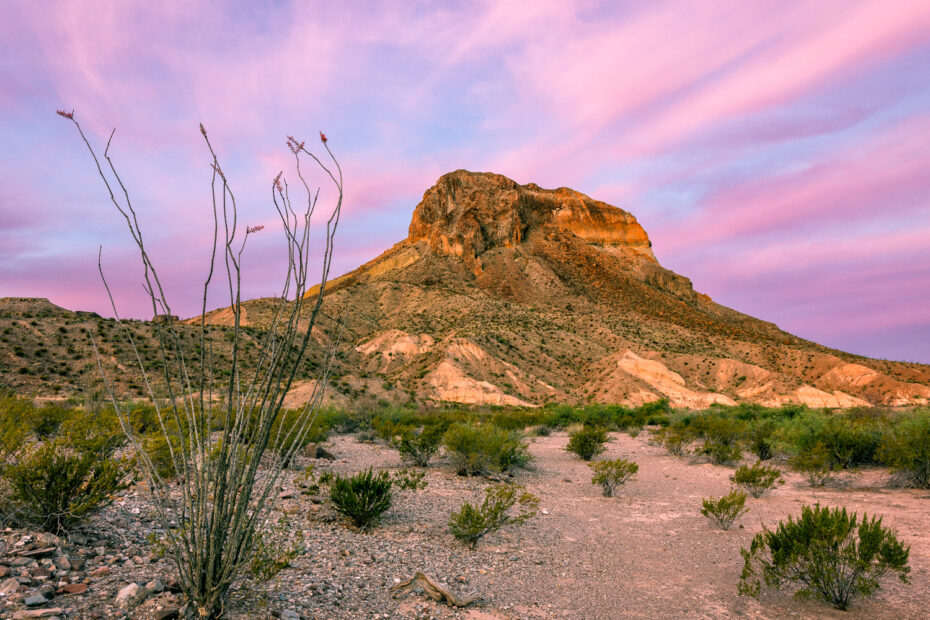
A Cerro Castellan sunrise in Big Bend NP. High clouds blocked the sun that morning giving us this wonderful pink color on the clouds.
A panorma of the right side of Juniper Canyon at the end of the Lost Mine Trail in Big Bend National Park in the summer of 2017.
Sunrise along the Lost Mine Trail in Big Bend National Park. I captured this photo after a 2.4 mile hike up the popular trail.
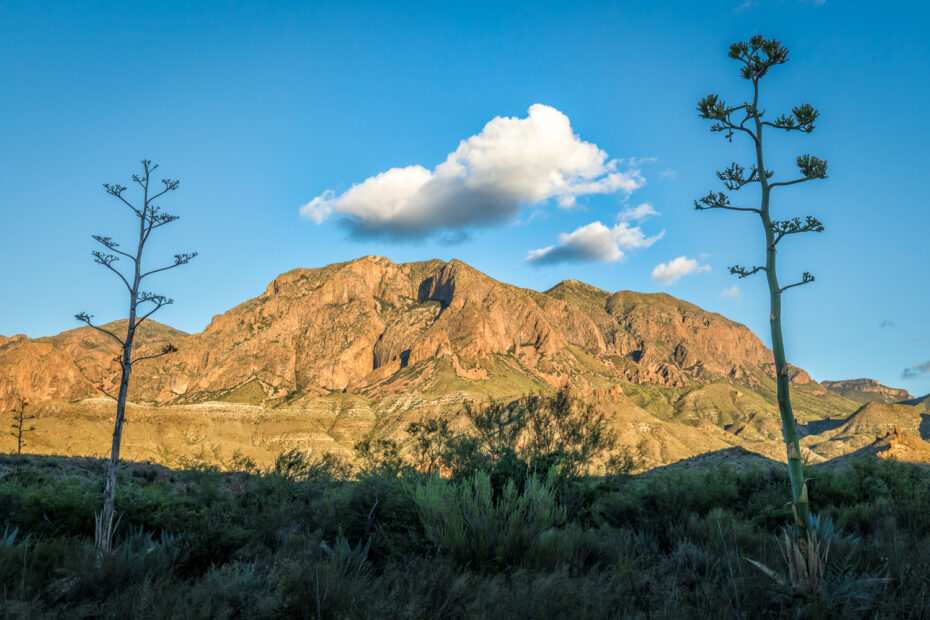
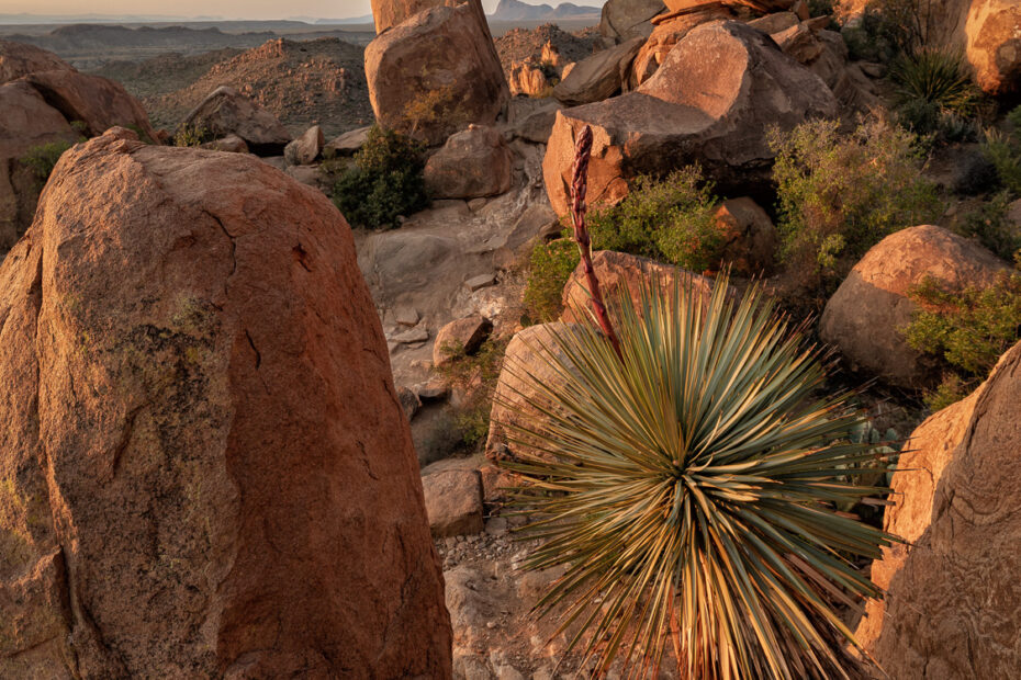
A pair of American Agaves (aka Sentry Plants or Century Plants) against the Chisos Mountains in the Big Bend National Park.
The Balanced Rock formation along the Grapevine Hills trail in Big Bend National Park. I captured this panorama in the summer of 2017.
A Rio Grande sunset photographed from the Nature Trail near the Rio Grande Village within the Big Bend National Park.
A pair of Lechuguilla plants, with stalks near the end of their cycle, posing at sunset in the Big Bend National Park.
Sunrise along Grapevine Hills in Big Bend National Park showing Balanced Rock on the left side of the image.
I have always been a big fan of kaleidoscopes so when I encountered Nature’s Kaleidoscope in the Cattail Falls area I had to photograph it.
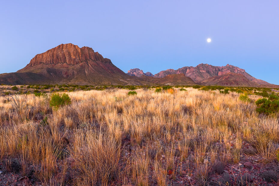
I photographed this moonset over the Chisos mountain last December during my fall trip to Big Bend NP. The sunrise light was perfect.
I captured this photograph of the moonset over Terlingua during my last trip to Big Bend NP. We hiked up a small hill to this vantage point.
I photographed Nugent Mountain and the Chisos Mountain Range from the Glen Springs area of Big Bend NP during a unique moonset and sunrise.
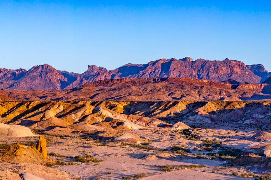
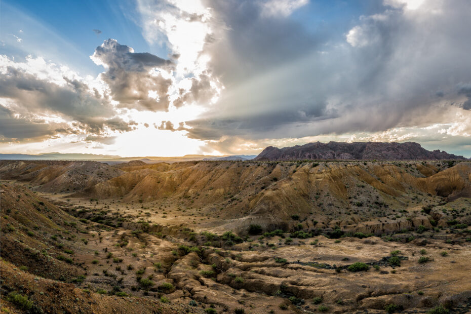
Another sunset photograph of the Badlands of Big Bend NP. This location is now a regular stop during my photography trips to the park.
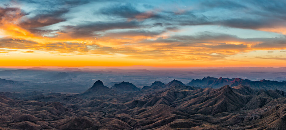
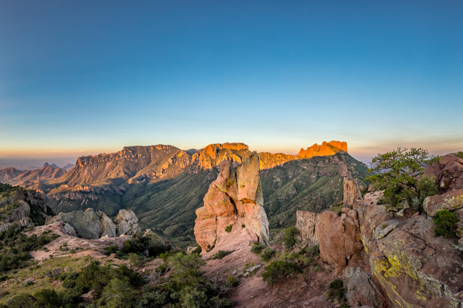
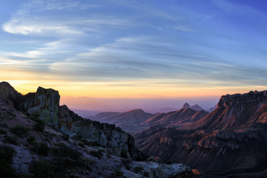
I decided to post this South Rim Panorama so you could get a feel for what a sunrise at the top of the South Rim at Big Bend NP looks like.
One of the most beautiful views in the entire Big Bend NP has to be the South Rim View. This vantage point showcases the Santa Elena Canyon.
A favorite hike in Big Bend NP is up the Grapevine Hills Trail to Balanced Rock. It was there where I captured another Balanced Rock Sunrise.
The most memorable activity from my last trip to Big Bend NP was the 12-mile hike to the South Rim where I captured this South Rim Sunrise.
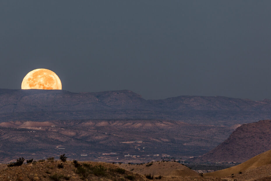
I photographed the moonrise over Castellan Mountain at Big Bend National Park during a very rare event. The moon was larger than normal.
Chimneys Trail in Big Bend National Park is a fairly easy hike that leads to a nice geological formation called the Chimneys.
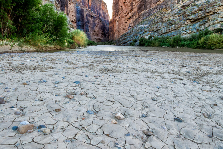
I captured this photograph of the Dry Riverbed along the Santa Elena Canyon last spring during my last visit to Big Bend National Park.
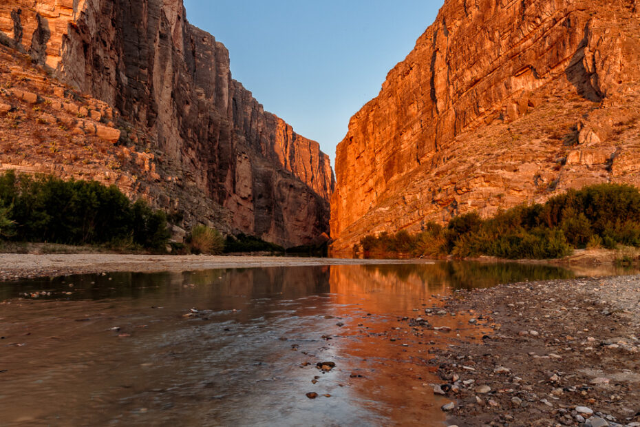
I captured this photograph of the Santa Elena Canyon in Big Bend last April. I have been to the canyon multiple times and I have yet to get a good photograph with nice clouds.

I photographed this desert flora sunset during my trip to Big Bend NP last year. The clouds were sparse but the desert flowers were amazing.
This image taken last December of another sunrise on Big Bend is from the Lost Mine Trail, another one of my favorite hikes in the park.
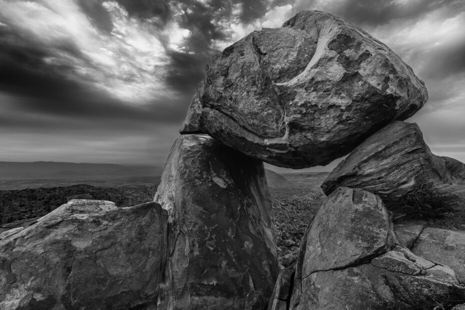
One of my favorite Big Bend hikes is the hike to Balanced Rock. I hiked up early to capture this Balanced Rock night sky image.
One of my favorite spots, and one of the most geologically dramatic areas in Big Bend National Park is the Santa Elena Canyon area.

This photograph of the Chisos Mountain Range and the two Century Plants was taken at sunset on the western side of the Big Bend National Park.
We normally stop along Glen Springs Road to photograph the sunrise onto Nugent Mountain and the Chisos Mountain Range on our way out of Big Bend National Park.
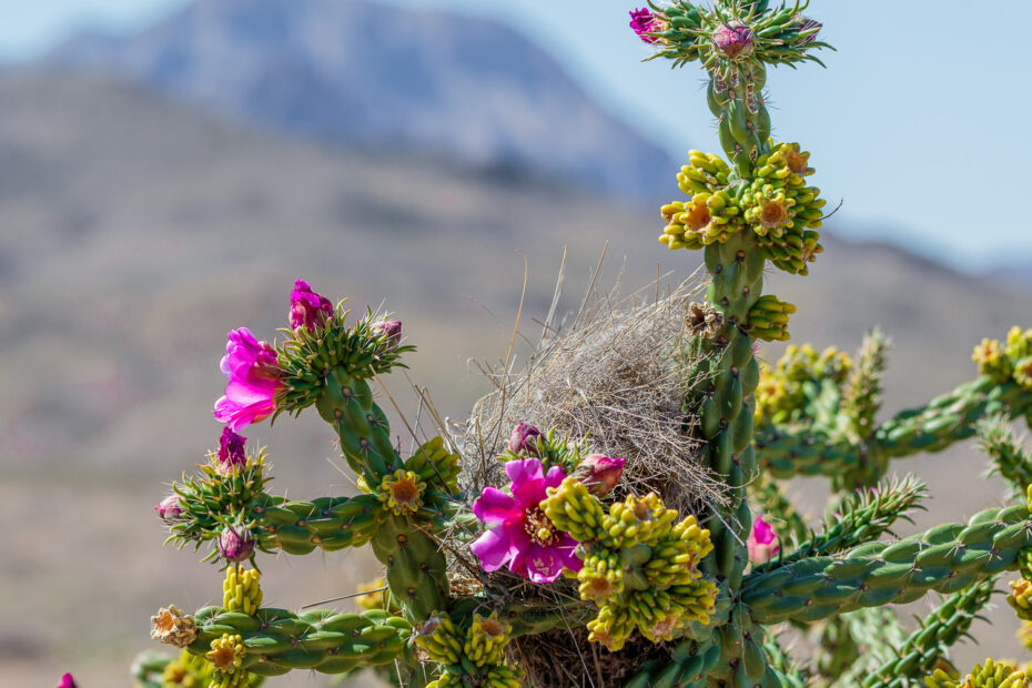
Desert plants like this Tree Cholla are not only beautiful but they have adapted to the environment and have been surviving and thriving for millennia.
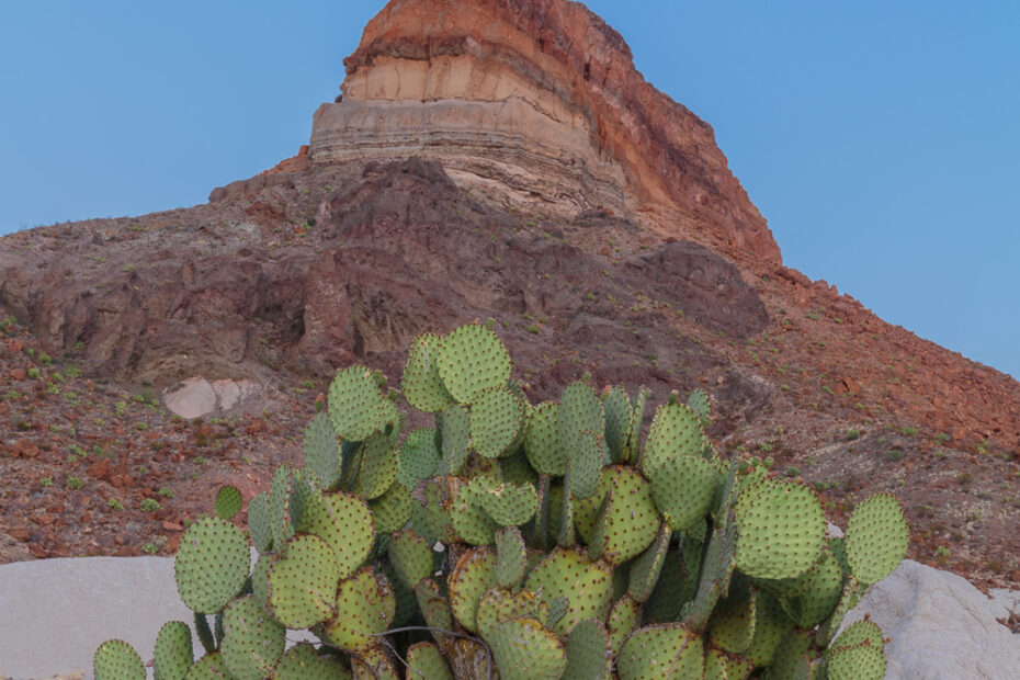
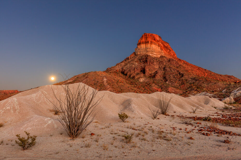
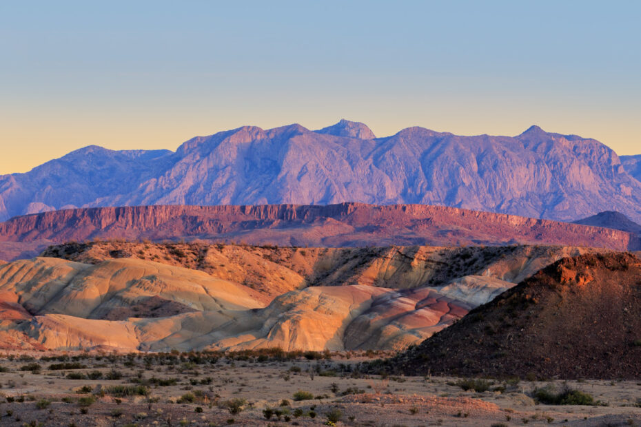
Cerro Castellan (Castellan Mountain) is located near the Castolon Visitors Center (note the different spelling) on the scenic Ross Maxwell Drive in the Big Bend National Park.
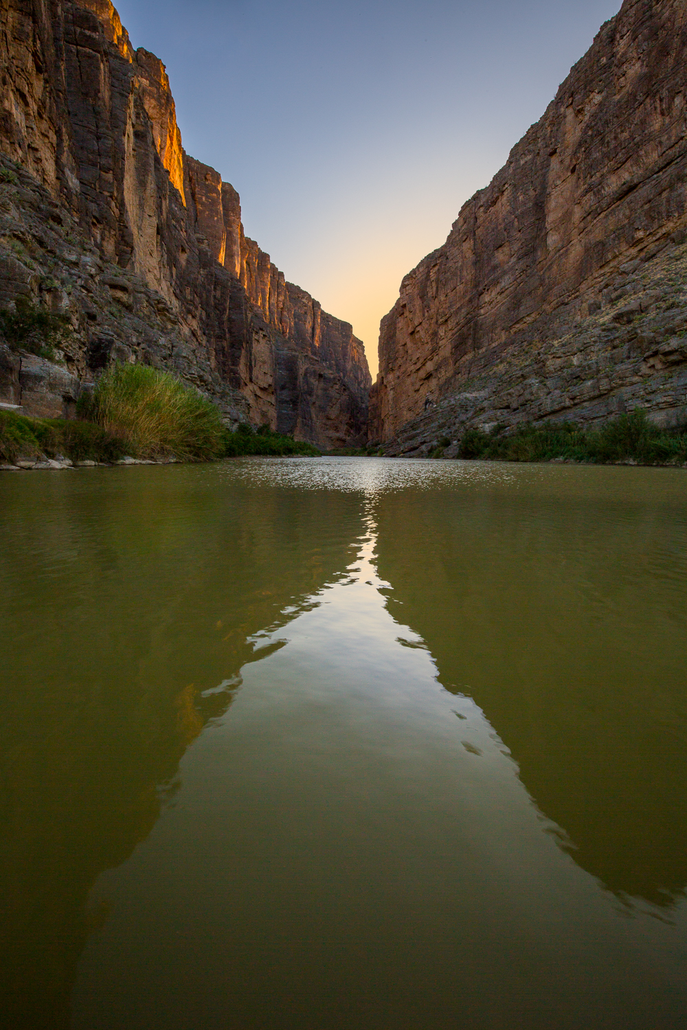
One of our favorite photography locations in the Big Bend National Park is Santa Elena Canyon. We usually photograph the canyon at sunrise and we decided to try a sunset shot as well.
The Big Bend National Park is located in the Chihuahuan Desert. This desert is the second largest in North America, covering about 140,000 square miles.
It is a tradition during our annual trips to the Big Bend National Park to stop along the Glen Springs Road for a sunrise photo. This year was no exception.
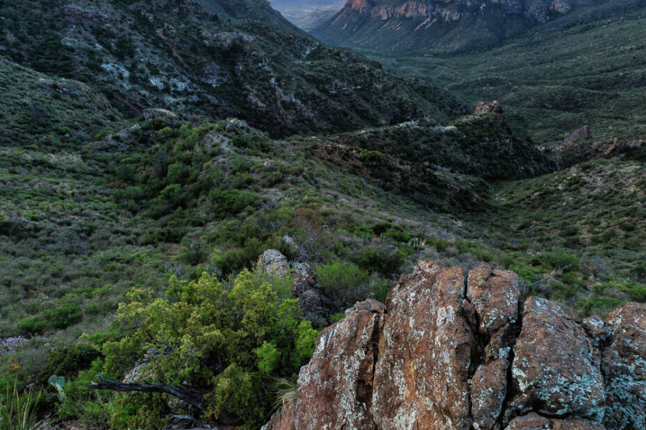
One of the things that I enjoy about my visits to the Big Bend National Park is exploring new locations. One of the new trails we explored was the Chimneys trail.
One of my favorite hikes in the Big Bend NP is the hike up the Grapevine Hills Trail. T’s an easy 2.2-mile hike that leads to the Balanced Rock formation
My favorite hike in all of the park is the Lost Mine Trail hike. There are may Texas Wildflowers and geological formations along the route.
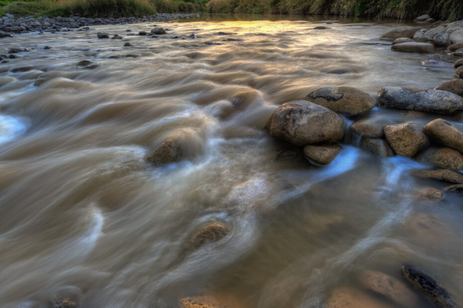
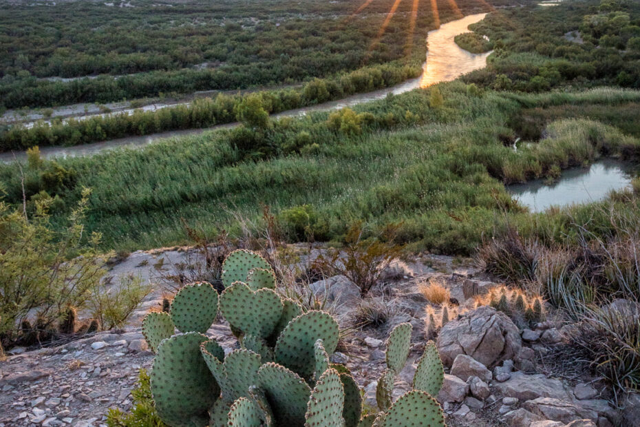
The Rio Grande serves as a border between the US and Mexico. You can access it throughout the park, however, this photograph was taken outside the park.
We usually stop at the “Ocotillo Fields” near the park entrance to photograph the sunset on our first day at the Park. The official road is Texas Highway 118 and it’s named “Panther Junction Road”.
I’m off to my annual spring trip to Big Bend and I thought I would share my top five landscape photos from my 2015 trips. This one merited an Honorable Mention.
This photo of Juniper Canyon was taken last year during my first group photography trip to Big Bend NP. It was taken from the Lost Mine Trail overlook.
This photograph was captured in Big Bend NP at the end of Grapevine Hills Trail, where the Balanced Rock formation resides. I posted a similar photograph titled “Balanced Sunrise” last December.
We had a chance to visit Boquillas Canyon during my trip to Big Bend NP. The Canyon is the easternmost of the 3 main narrows sections along the Rio Grande.
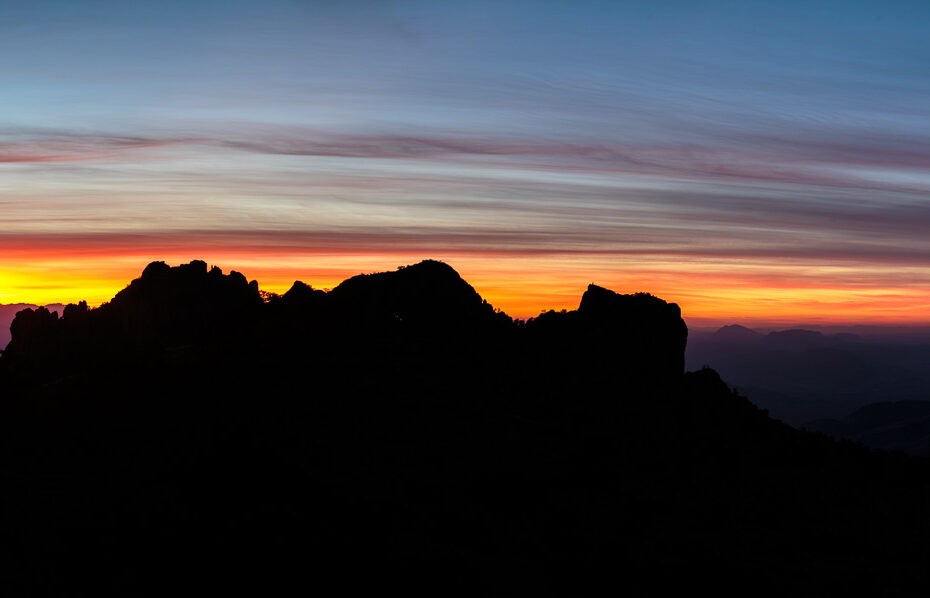
I like shooting silhouettes, so, when I was shooting the sunrise at the Lost Mine Trail in BBNP, I decided this was a perfect opportunity for a silhouette.
I posted a few images taken at the Lost Mine Trail during my recent trip to BBNP. The image below of Juniper Canyon was taken at sunrise from the same spot.
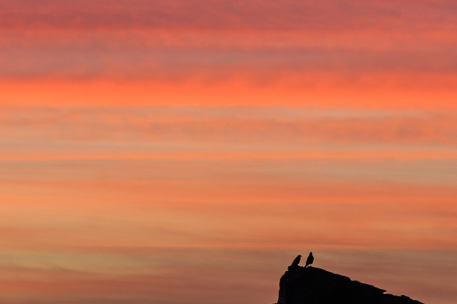
Common Ravens are observed throughout the Big Bend area. Of the birds classified as perching birds, the Common Raven is the largest, the size of a hawk.
I titled this one “Balanced Sunrise” because I was trying to make sure I got the rock formation and a good sunrise all at the same time. This is one of my favorite photos from my trip.
During a rip to the Big Bend National Park, I noticed this very interesting area near the park’s western entrance. We labeled it “The Badlands”.
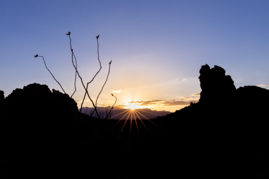
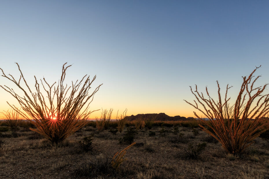
This Ocotillo Sunset was taken in an “ocotillo field” that is located near the main entrance to the park on Highway 118 close to mile marker #21.
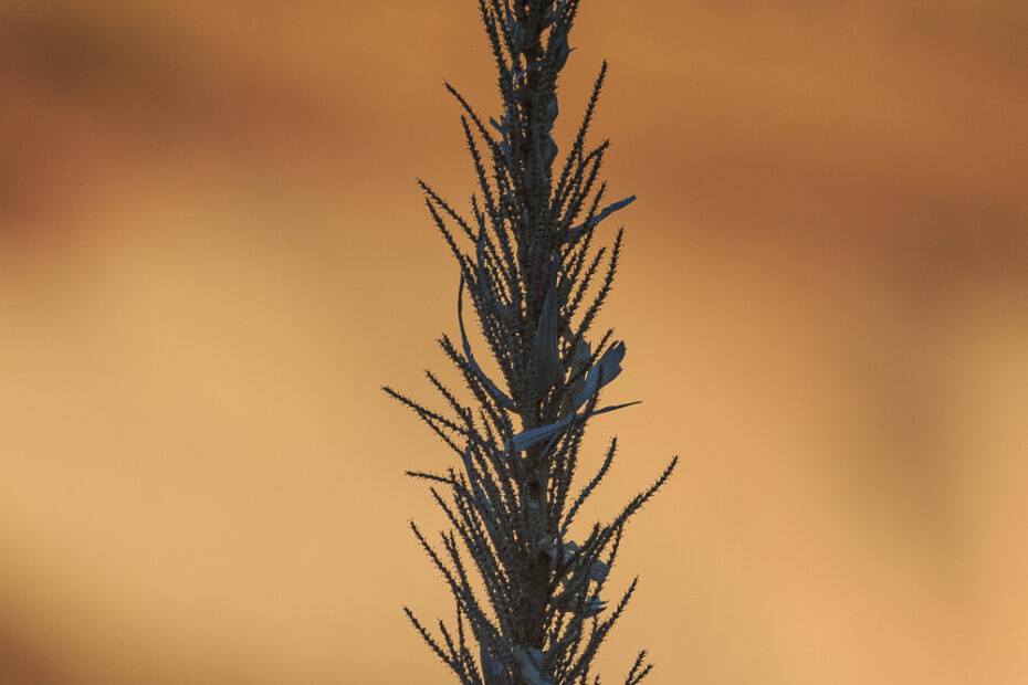
The Sotol plant is very prominent throughout the Big Bend NP. It was during a trip to the park that I photographed the now dead and empty stalk.
We normally associate fall colors with Maple, Oak, Cottonwood and Aspen trees but, we seldom associate desert plants with fall colors.
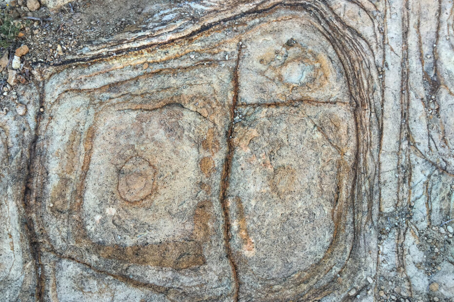
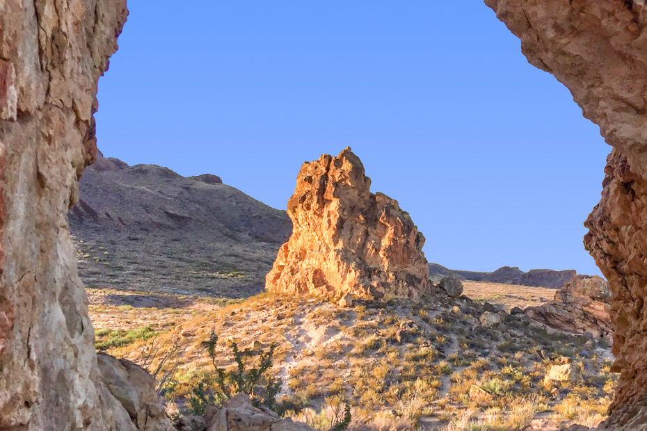
The BBNP is an amazing geological wonderland. There are many interesting rock formations impacted by Spheroidal Weathering along the Grapevine Hills Trail.
This image was taken with my tripod in the water and set to about 18-inches off the surface. I guess you could say that I was literally standing on the border.